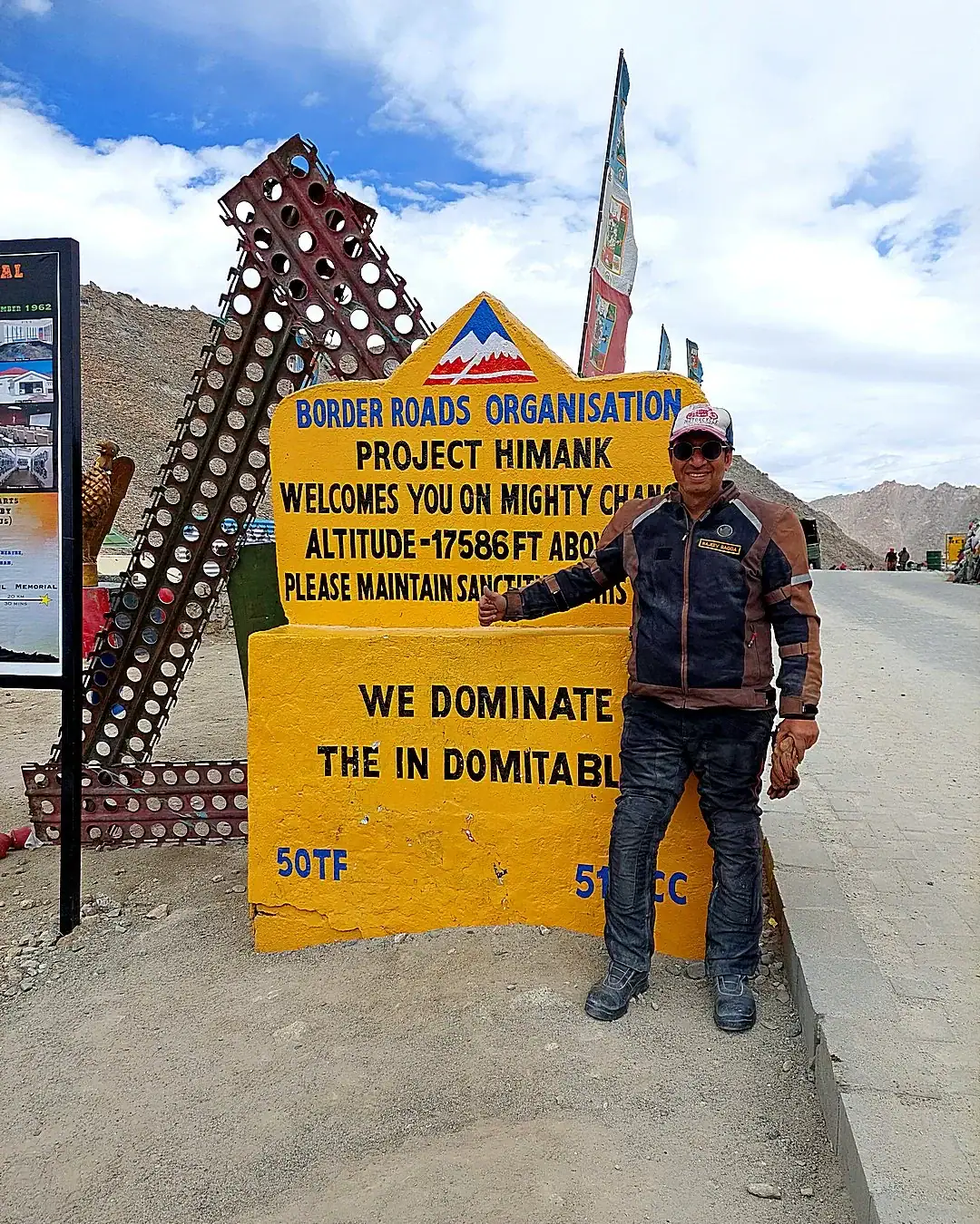
Ask anyone in Leh for the highest motorable road in the world and half of them will point you up the hill to Khardung La. The sign at the top agrees with them. The sign is wrong, and has been for years. The record has moved east, to a part of Ladakh most visitors never see, and it has moved twice.
First it went to Umling La, at 19,024 ft. Then, in October 2025, the Border Roads Organisation finished a road over Mig La at 19,400 ft and beat its own record. Both passes are ridden from the same village, Hanle, a day apart. Getting to Hanle is the interesting part.
Where the coach tours turn around
In Nubra we had a choice. The cafes at Turtuk were full and the dunes at Hunder had camels queueing for tourists, so we turned away from both and pointed the motorcycles at Hanle and Tso Moriri. It was the best decision of that trip.
Eastern Ladakh is the Changthang, a high cold desert that runs up against the Tibetan border. The villages are counted in households. The lakes sit higher than most mountains you have climbed. And the tourist traffic, which is heavy at Pangong, thins to almost nothing once you turn south.
Pangong, briefly
Pangong Tso is 134 km long and sits at 4,225 m. Less than half of it is in India. The rest runs into Tibet, which is why there are soldiers on the shore and a lot of paperwork in your pocket. The water changes color through the day, which every photograph of it will tell you, and it freezes solid in winter, which most of them will not.
Most people ride to the lake, take the picture and ride back to Leh. We leave the selfie-stick end of it behind and take the border track south.
There are no bad roads in Eastern Ladakh
After ten days of mostly brilliant tarmac, we found that there were no bad roads in Eastern Ladakh either. There were no roads at all.
The water crossings were not the problem. In September and October the channels are tame. In June and July the snowmelt fills them, and by afternoon they are gushing. The problem was sand. You try to bully your way through it and hope there is no rock buried in the track, because you are riding blind most of the time anyway. Sometimes it works. Sometimes you end up stuck at an unnatural angle, with your back wheel not at the back of the motorcycle but somewhere beside you. Then comes the slow business of digging yourself out of a sandpit at over 12,000 ft, with your oxygen saturation already in the mid-80s.
And then there were the dogs. A pack of wild Himalayan dogs decided that a man on a motorcycle was worth chasing. Bees, elephants, snakes, and now this. The biker is clearly the new endangered species. The camera caught the dogs. It did not catch my vocabulary.
The evening rum, with the leftover sand in your mouth, tastes better than tequila with salt. Just saying.
Rezang La and Tsaga La
The track south from Pangong runs past the memorial at Rezang La, where a company of Indian soldiers fought to almost the last man in 1962. The pass itself, at 5,005 m, sits up on the Line of Actual Control. You stop, you read the names, and the next half hour on the motorcycle is quieter than the half hour before it.
Then Tsaga La at 15,207 ft, and the plateau opens into a great brown nothing that goes on for hours, until Hanle appears.
Hanle and the darkest sky in India
Hanle is a monastery, a few hamlets, and a telescope. The Indian Astronomical Observatory sits on Mt Saraswati at about 4,500 m, and its 2 m Himalayan Chandra Telescope has been looking up from here since 2001. In December 2022 about 1,073 sq km around it became India’s first dark sky reserve.
What that means for a rider is simple. Switch off your headlamp after dinner, walk twenty steps from the homestay and look up. You will see more stars than you knew were there, and you will be very cold while you do it.
The highest motorable road in the world, twice in two days
Hanle is the base for both record passes. One day you ride out over Photi La to Umling La, 19,024 ft, and back. The next day you ride out through Likaru to Mig La, 19,400 ft, on a road that runs on to Fukche near the border, and back again.
Up there the air holds about half the oxygen it does at sea level. Your engine makes about half its power. So do you. Nobody sprints at 19,000 ft, and nobody should try. You ride slowly, you stop for the photograph, and you get back down before the headache arrives.
It is the only place on Earth where you can ride the two highest motorable roads in the world from one village. That fact alone is worth the ride. The ride is worth considerably more.
Tso Moriri, then home along the Indus
From Hanle the plateau turns into a lake district. A fast, empty run to Loma and the Indus, then a rough climb over Namshang La at 16,273 ft, past a string of high lakes, to Tso Moriri at 4,522 m. It has been a Ramsar wetland since 2002, and the gompa at Korzok on its shore is about 400 years old.
The way back follows the Indus, past the hot springs at Chumathang, where the river runs beside ground that is quietly boiling, and on into Leh.
Before you go
- Permits. Eastern Ladakh is border country and every visitor needs paperwork. The rules changed recently. They are in Ladakh permits in 2026.
- Acclimatization. You do not ride to 19,000 ft on your second day in Ladakh. Here is how riders acclimatize.
- The motorcycle. Thin air changes how it climbs, brakes and starts. Here is what actually breaks at 17,000 ft.
- Timing. September and October bring tamer water crossings and colder nights. Here is the best time to ride Ladakh.
We ride all of this on Royal Enfields as a loop from Leh, with a mechanic and a support vehicle. The full route, day by day, is on the Eastern Ladakh tour page. If you would rather start with Khardung La, Nubra and Pangong, that is Mission High-La, and all our routes are on the Ladakh motorcycle tours page.
Ready to ride? This is what Outriders does. Experienced lead riders, routes that don’t exist on package tours. See the Eastern Ladakh tour →