THE EDGE OF REASONABLE DOUBT

CLIFFHANGER: THE PASS OF TRUTH

A Negotiation with Gravity, Carved Through Rock, Ice, and Himalayan Vertigo
The Edge of Reasonable Doubt
Cliffhanger: The Pass of Truth
A Negotiation With Gravity, Carved Through Rock, Ice, and Himalayan Vertigo

WHY RIDE THE SACH PASS?

THE PASS OF TRUTH

The Cliffhanger is not about ticking off another Himalayan pass; it is about engaging with terrain in its most unedited form. This route exists because people needed to move—between valleys, across weather, along mountains that do not negotiate. Originally carved as an entry route into the remote Pangi Valley, the track traces high above the Chandrabhaga River, cutting across a stark mountain corridor often associated with the outer reaches of the Pir Panjal region. The road itself is narrow, unguarded, and functional—built for necessity, not comfort—and that purpose still defines the ride today.

You ride the Cliffhanger because some routes still demand respect rather than speed. The long, physically taxing cliffside stretch—often close to ten hours of sustained riding—forces a different rhythm: slower decisions, cleaner lines, and disciplined energy management. With glaciers above and the river falling far below, the exposure is constant but never theatrical. The landscape removes distraction and excess, leaving only what matters: rider, machine, and terrain. That clarity—earned mile by mile—is the truth of this pass, and exactly why it remains one of the world’s most dangerous yet exciting routes. 

Motorcycle riding through narrow rocky canyon on Sach Pass trail.

TOUR SNAPSHOT

Why Ride The Sach Pass?
The Pass of Truth
Motorcycle riding through narrow rocky canyon on Sach Pass trail.
The Cliffhanger is not about ticking off another Himalayan pass; it is about engaging with terrain in its most unedited form. This route exists because people needed to move—between valleys, across weather, along mountains that do not negotiate. Originally carved as an entry route into the remote Pangi Valley, the track traces high above the Chandrabhaga River, cutting across a stark mountain corridor often associated with the outer reaches of the Pir Panjal region. The road itself is narrow, unguarded, and functional—built for necessity, not comfort—and that purpose still defines the ride today.
You ride the Cliffhanger because some routes still demand respect rather than speed. The long, physically taxing cliffside stretch—often close to ten hours of sustained riding—forces a different rhythm: slower decisions, cleaner lines, and disciplined energy management. With glaciers above and the river falling far below, the exposure is constant but never theatrical. The landscape removes distraction and excess, leaving only what matters: rider, machine, and terrain. That clarity—earned mile by mile—is the truth of this pass, and exactly why it remains one of the world's most dangerous yet exciting routes.
Tour Snapshot
📅
Season: June - September
Duration: 14 Days / 13 Nights
📍
Distance: ~1300 Miles
Difficulty: Tough
🏍
Machine: RE Himalayan/Classic
Upcoming Adventures
Sep 02 — Sep 15, 2026
4 Seats Left
Start Rider Assessment

THE LAY OF THE LAND

WHAT YOU'RE RIDING INTO

HISTORY & HERITAGE

This route moves from old trading towns and crowded plains into mountain regions that were historically isolated for much of the year. The road network leading toward Pangi Valley evolved out of necessity—seasonal movement, trade, and survival in harsh terrain.

For decades, access into these valleys depended on weather windows and local knowledge rather than mapped certainty. Even today, the ride passes through areas where traditions, architecture, and daily life reflect a long relationship with isolation, altitude, and self-reliance.

TERRAIN & CLIMATE

The terrain changes constantly and without warning. Hot plains give way to broken foothills, which then rise sharply into cold, high-altitude mountain zones. Over the course of the route, riders transition from near-sea-level elevations to passes exceeding 4,000 meters, often within a matter of days. 

Weather can shift quickly from heat and dust to wind, cold, and thin air. River valleys, exposed ridgelines, forested stretches, and glacier-fed terrain coexist along the same journey.  

ROADS & LIFE

The ride moves through modern India as it is lived today. Busy cities, chaotic traffic, multi-lane highways filled with trucks and buses, roadside towns, and frequent slowdowns are part of the experience before the landscape opens up. These early stages demand patience, alertness, and precise riding—skills as important here as they are in the mountains.

As the route climbs, infrastructure thins, roads narrow, and settlements become sparse. Mastering this contrast is what defines the completeness of this journey.

The Lay of the Land
What You're Riding Into
🏛
History & Heritage
This route moves from old trading towns and crowded plains into mountain regions that were historically isolated for much of the year. The road network leading toward Pangi Valley evolved out of necessity—seasonal movement, trade, and survival in harsh terrain.
For decades, access into these valleys depended on weather windows and local knowledge rather than mapped certainty. Even today, the ride passes through areas where traditions, architecture, and daily life reflect a long relationship with isolation, altitude, and self-reliance.
Terrain & Climate
The terrain changes constantly and without warning. Hot plains give way to broken foothills, which then rise sharply into cold, high-altitude mountain zones. Over the course of the route, riders transition from near-sea-level elevations to passes exceeding 4,000 meters, often within a matter of days.
Weather can shift quickly from heat and dust to wind, cold, and thin air. River valleys, exposed ridgelines, forested stretches, and glacier-fed terrain coexist along the same journey.
🛣
Roads & Life
The ride moves through modern India as it is lived today. Busy cities, chaotic traffic, multi-lane highways filled with trucks and buses, roadside towns, and frequent slowdowns are part of the experience before the landscape opens up. These early stages demand patience, alertness, and precise riding—skills as important here as they are in the mountains.
As the route climbs, infrastructure thins, roads narrow, and settlements become sparse. Mastering this contrast is what defines the completeness of this journey.

ROUTE OVERVIEW: THE CLIFFHANGER RUN

A high-mountain crossing originally built to access the remote Pangi Valley, the Cliffhanger runs on narrow mountain tracks along exposed cliff faces, high above the Chandrabhaga river. The route combines ordinary Himalayan roads with one long, demanding cliffside stretch that defines the ride. Expect long hours in the saddle, changing surfaces, and sustained focus through high-altitude terrain.

Zoom in. Tilt the terrain. Follow the climbs and descents. This interactive route shows you exactly where we ride and rest, and occasionally wonder who convinced us this was a good idea.

Route Overview: The Cliffhanger Run
Where We Ride, Rest, And Occasionally Wonder Who Convinced Us This Was A Good Idea
Full route map: 14-day Cliffhanger Sach Pass motorcycle tour, Delhi–Dharamshala–Sach Pass–Amritsar loop — Outriders Co.
👆 Tap For Live Satellite View
A high-mountain crossing originally built to access the remote Pangi Valley, the Cliffhanger runs on narrow mountain tracks along exposed cliff faces, high above the Chandrabhaga river. The route combines ordinary Himalayan roads with one long, demanding cliffside stretch that defines the ride. Expect long hours in the saddle, changing surfaces, and sustained focus through high-altitude terrain.
Launch 3D Satellite View

THE FULL ITINERARY

HOW THE DAYS UNFOLD, SUBJECT TO WEATHER, PHYSICS, AND COSMIC IRONY
ROUTE INTELLIGENCE
Every Stop Logged, Every Distance Measured, Every Altitude Checked, Every Signboard Treated As A Rumour
Red — fuel, permit, hazard, hard time limitGold — the reason you stopGrey — waypoint, tea, regroup
DAY 01Arrival in Delhi+
Altitude profile702 ft
No riding
Airport pickup — Indira Gandhi International (DEL)
Transfer included

We meet you at Terminal 3 and take you to the group hotel. Delhi at 702 ft is the lowest point of the trip; everything from here goes up.

Welcome Dinner
Included2 h

First meeting of the squad, ride leaders and mechanic. Route brief, bike allocation preview, and the water-crossing briefing you'll thank us for on Day 07.

DAY 02Delhi → Una+
Distance401 km
Altitude profile702 ft → 1,250 ft

Long plains day — we start before the city wakes. The only way to beat the GT Road.

KM 0Delhi

Rolling out at dawn, north on NH-44.

KM 70Murthal — Amrik Sukhdev dhaba
Breakfast45 min

The most famous parathas in North India, served since 1956. Order the aloo-pyaaz with white butter; watch a thousand truckers agree with you.

KM 147Karnal bypass
Fuel10 min

Tank up, stretch, go.

KM 230Ambala cantt
15 min

Chai and a leg-stretch where the Grand Trunk Road forks for Punjab.

KM 348Kiratpur Sahib
20 min

The Sutlej plains end here; the Shivaliks begin. Historic gurdwara town at the gateway to the hills.

KM 359Anandpur Sahib — Virasat-e-Khalsa
Optional45 min

Birthplace of the Khalsa, 1699. The museum's petal-roofed architecture by Moshe Safdie is worth the stop alone.

KM 382Nangal
15 min

The Bhakra-Nangal reservoir spreads out beside the road; wetland birdlife if you're early.

KM 401Una

Night halt. Nothing romantic, everything functional.

DAY 03Una → McLeod Ganj+
Distance~139 km
Altitude profile1,250 ft → 5,994 ft

The back-roads day: most of today runs on narrow village lanes through the Kangra foothills — clean, empty, single-lane tarmac threading spotless villages all the way to Kangra Fort. The kind of riding highways forgot.

KM 0Una — off the highway
Back roads

We leave NH-503 almost immediately for the village lanes: slate roofs, mustard terraces, and tarmac to ourselves.

KM 35Amb
10 min

Chai at a village crossing. Wave back; everyone waves first.

KM 100Kangra Fort
1 h

The back roads deliver you to the oldest recorded fort in the Himalayan foothills, mentioned by Alexander's chroniclers and sacked by every ambitious ruler since. Ramparts above the Banganga river.

KM 118Chamunda Devi temple
30 min

Shakti temple on the Baner river with the Dhauladhar wall rising straight behind it.

KM 134Dharamshala — Kotwali Bazaar

Past the HPCA cricket stadium — the one with snow peaks behind the sight screen — and into the lower town.

KM 135The Khara Danda climb
First gearWhen open20 min

The local's shortcut: a steep cemented lane that punches straight up through the bazaars to McLeod Ganj — 3 km instead of the main road's 10 winding km. First and second gear, walls close enough to touch, steeper than looks reasonable, more fun than looks possible. Landslides shut it some monsoons; when it's open, it's the way up.

KM 139McLeod Ganj

Tsuglagkhang complex, the Dalai Lama's temple, in the evening light. Bhagsu waterfall walk if legs allow.

DAY 04McLeod Ganj → Dalhousie+
Distance165 km
Altitude profile5,994 ft → 6,650 ft
KM 0McLeod Ganj

Downhill start through deodar.

KM 21Norbulingka Institute
1 h

Tibetan arts kept deliberately alive: thangka painters, woodcarvers, Japanese-style gardens. The quietest place in the valley.

KM 44Shahpur
10 min

Chai on the Kangra–Pathankot road.

KM 83Nurpur Fort
30 min

Ruined Pathania fort with a Krishna temple still working inside its walls. Jahangir named the town for his empress.

KM 139Banikhet
Fuel15 min

Junction bazaar and the last proper market before Dalhousie. Top up.

KM 165Dalhousie

Raj-era ridge town at 6,650 ft: Gandhi Chowk, St. John's church (1863), and pine air the British bottled their homesickness in.

DAY 05Dalhousie Rest Day+
Distance~50 km local
Altitude profile6,650 ft
Khajjiar
24 km2–3 h

The "Mini Switzerland" meadow at 6,437 ft — a saucer of green with a lake in the middle and a 360° deodar rim.

Dainkund Peak road
1.5 h

The highest point around Dalhousie; the Pholani Devi temple walk along the ridge is the best view-per-step ratio of the week. Air Force station at the top — cameras pointed outward only.

Kalatop sanctuary
1 h

A forest road through a wildlife sanctuary: barking deer, langurs, Himalayan black bear if the day is strange. A taste of broken tarmac before the real thing.

Bike check, Dalhousie
Mandatory30 min

Brakes, chains, spares loaded. Tomorrow the road stops being polite.

DAY 06Dalhousie → Bairagarh+
Distance141 km
Altitude profile6,650 ft → 3,064 ft → 6,699 ft
KM 0Dalhousie

Drop off the ridge toward the Ravi.

KM 19Chamera reservoir viewpoint
15 min

The dammed Ravi turns an improbable teal between pine slopes. The classic photo stop of the Chamba road.

KM 53Chamba town
Last reliable fuelLast ATM1.5 h

A thousand-year-old hill capital: the Laxmi Narayan temple complex (10th century), the Chaugan green, Bhuri Singh Museum's miniature paintings. Fill every tank to the brim — the Killar pump is a rumour with opening hours.

KM 115Tissa
20 min

Chai in the Churah valley's main village; last civil hospital before Pangi.

KM 141Bairagarh
Evening briefing

Staging village at 6,699 ft. Briefing on tomorrow's water crossings: order, lines, and why we leave at dawn.

DAY 07Bairagarh → Sach Pass → Killar+
Distance79 km
Altitude profile6,699 ft → 14,455 ft → 9,403 ft

The nallahs are fed by glacier melt: ankle-deep at 8 AM, wheel-swallowing by 2 PM. We cross before the sun does its work.

KM 0Dawn start
Hard time limit

Wheels rolling at first light. The mountain sets the schedule today; we just obey it.

KM 20Satrundi checkpost
ID check20 min

Police post at 11,558 ft; riders sign the undertaking. Beyond here the road stops pretending.

KM 25The waterfall crossings
Feet downSpotter ahead

A sequence of nallahs across the road — Madgram is the honest one. Steady throttle, first gear, spotter on the far bank.

KM 33SACH PASS — 14,455 ft
Chai tent in season45 min

Prayer flags, a glacier-cut wall of snow into July, and a seasonal chai tent run by the hardiest entrepreneur in Himachal. The photograph this tour is named for.

KM 45The descent wall

Switchbacks cut into scree with the Pangi valley opening 5,000 ft below. Second gear, both brakes, full attention.

KM 60Bagotu
15 min

Regroup at the bottom nallah; last water crossing of the day.

KM 79Killar

A shelf of a town hanging over the Chenab at 9,403 ft. You have crossed Sach Pass. Say it out loud.

DAY 08Killar → Kishtwar+
Distance120 km
Altitude profile9,403 ft → 5,348 ft

Out of Killar the road becomes a shelf blasted into a rock face above the Chenab: single-lane, no guardrails, drops the height of skyscrapers. The most infamous stretch in the Indian Himalaya — the tour's namesake.

KM 0The Cliffhanger
Support vehicle behindEgos parked

Single file, steady pace, no overtaking. The rock roof brushes your helmet in places; the Chenab glitters a very long way down.

KM 24Dharwas
15 min

Last Himachal village; chai with a cliff view.

KM 30Sansari Nallah
State border check20 min

Himachal hands you to Jammu & Kashmir mid-gorge. Papers ready.

KM 59Gulabgarh (Paddar)
LunchFuel if available45 min

Lunch in the sapphire valley — the Paddar mines above produced some of the world's finest blue stones. The Machail Mata pilgrimage route starts here.

KM 120Kishtwar

Saffron fields and walnut groves at the Chenab's bend. The Chowgan green at dusk fills with the whole town.

DAY 09Kishtwar → Patnitop+
Distance128 km
Altitude profile5,348 ft → 6,827 ft
KM 0Kishtwar

NH-244 along the Chenab gorge.

KM 26Thathri
15 min

Chai above the river; the gorge at its narrowest.

KM 61Doda
Fuel30 min

District town climbing its hillside; fuel and stretch.

KM 107Peerah — rajma-chawal dhabas
Lunch1 h

The most famous plate on the Jammu–Srinagar corridor: Peerah's desi-ghee rajma with anardana chutney. Truckers plan their day around it; so do we.

KM 114Batote

Junction with NH-44; the Chenab road ends.

KM 128Patnitop

Meadows at 6,827 ft, deodar, the Naag temple, and the first proper rest since Dalhousie.

DAY 10Patnitop → Pathankot+
Distance224 km
Altitude profile6,827 ft → 1,086 ft
KM 0Patnitop

Down the mountain on sweepers.

KM 11Kud — Prem Sweets
Patisa30 min

A highway sweet shop running since 1925; the desi-ghee patisa is a century-old institution. Boxes get strapped to pillions here.

KM 48Udhampur
Fuel15 min

Garrison town; tanks and chai.

KM 120Jammu bypass

We skirt the temple city and run the plains.

KM 199Lakhanpur barrier
J&K exit check20 min

Toll and checking out of the union territory.

KM 224Pathankot

Punjab. Flat roads, full plates, easy night.

DAY 11Pathankot → Amritsar+
Distance113 km
Altitude profile764 ft
KM 0Pathankot

Through green Punjab: mustard, poplars, gurdwara domes.

KM 25Dinanagar
10 min

Chai among the grain markets.

KM 74Batala
15 min

Historic town of the Ramgarhia misl; old havelis off the bazaar.

KM 113Golden Temple, Amritsar
2+ h

Harmandir Sahib floating on its pool of nectar; langar with ten thousand strangers. Jallianwala Bagh is two minutes' walk and a century of silence.

Wagah border ceremony
28 kmLeave by 3 PM3 h round

The most theatrical border closing on Earth. Hard departure time to make the stands.

Dinner — Kesar da Dhaba / Bharawan da Dhaba

Century-old Amritsari kitchens: dal makhani finished overnight, kulchas that ruin all other kulchas.

DAY 12Amritsar → Ambala+
Distance257 km
Altitude profile764 ft → 899 ft
KM 0Amritsar

The Grand Trunk Road — Sher Shah Suri's 16th-century spine of the subcontinent.

KM 79Jalandhar bypass
Fuel15 min

Tanks and chai.

KM 141Ludhiana bypass
15 min

Industrial Punjab at full volume.

KM 205Fatehgarh Sahib, Sirhind
45 min

Gurdwara marking the martyrdom of Guru Gobind Singh's youngest sons; Mughal-era Aam Khas Bagh across town.

KM 257Ambala

Cantonment night halt.

DAY 13Ambala → Delhi+
Distance241 km
Altitude profile899 ft → 702 ft
KM 0Ambala

Last riding day; the GT Road south.

KM 54Kurukshetra
1 h

The battlefield of the Mahabharata: Brahma Sarovar's great tank and Jyotisar, where the Gita was spoken under a banyan.

KM 92Karnal
15 min

Chai.

KM 129Panipat
20 min

Three battles decided India's fate on these plains; the Kabuli Bagh mosque remembers the first.

KM 172Murthal
Last paratha45 min

The loop closes where it opened. Order the same paratha; it tastes different after Sach Pass.

KM 241Delhi — farewell dinner
Included

Boots off, stories up. The Cliffhanger is now something you say in the past tense.

DAY 14Departure from Delhi+
Altitude profile702 ft
No riding
Airport drop
Transfer included

Breakfast, embraces, promises to return. A strong chance you'll book the next one within the week.

The Full Itinerary
How The Days Unfold, Subject To Weather, Physics, And Cosmic Irony
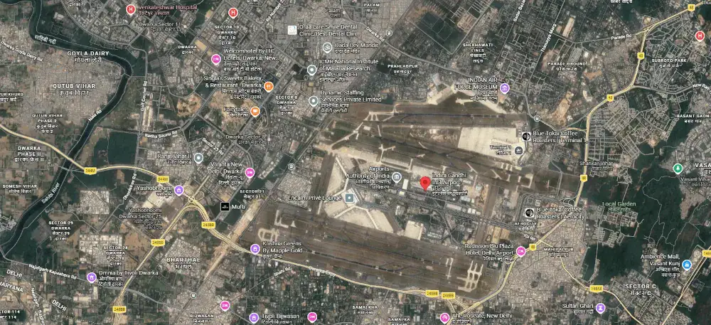
Route map of New Delhi, arrival and departure hub for Outriders Co. India motorcycle tours.
👆 Tap For Live Satellite View
Day 01
Arrival In Delhi
↑ 700–1000 Feet
Welcome to Delhi — vibrant, loud, and delicious; where aromas, colours, and crowds form the world's most efficient assault on your senses. Exactly the warm-up your senses need before the mountains. Airport pickup, hotel check-in. Evening: Welcome Dinner. You meet the crew, other riders, and your future adventure family. The jokes start early; the bragging rights start later.
Day 2 route map: Delhi to Una — Cliffhanger Sach Pass motorcycle tour, Outriders Co.
👆 Tap For Live Satellite View
Day 02
Delhi → Una
↑ 1200–1800 Feet  🏍 230 Miles
Baptism by fire as you punch out of Delhi's chaos and settle into long highway miles across the plains; it's a steady 6–7 hour ride designed to get the machine and your body into rhythm. Overnight is in a comfortable highway hotel in Una—clean rooms, hot shower, early dinner, and an early sleep.
Day 3 route map: Una to McLeod Ganj — Cliffhanger Sach Pass motorcycle tour, Outriders Co.
👆 Tap For Live Satellite View
Day 03
Una → McLeod Ganj
↑ 6800 Feet  🏍 80 Miles
A shorter 3–4 hour ride, but with concentrated hill-road work—switchbacks, local traffic, and narrow sections that keep you honest. McLeod Ganj is the spiritual and cultural pivot of the route—home of the Dalai Lama and the Tibetan government-in-exile—and you'll overnight in a solid hill-town hotel near the cafés, monasteries, and viewpoints.
Day 4 route map: McLeod Ganj to Dalhousie — Cliffhanger Sach Pass motorcycle tour, Outriders Co.
👆 Tap For Live Satellite View
Day 04
McLeod Ganj → Dalhousie
↑ 6600 Feet  🏍 80 Miles
Expect 6–7 hours of rolling mountain riding with long scenic stretches, patchy road surfaces in places, and a steady accumulation of fatigue. Dalhousie lands you in classic hill-station calm—pine forests, colonial-era charm, and ridge walks—overnighting in a heritage-style hill hotel built for warm beds and slow evenings.
Day 5 route map: Dalhousie Rest Day — Cliffhanger Sach Pass motorcycle tour, Outriders Co.
👆 Tap For Live Satellite View
Day 05
Dalhousie Rest Day
↑ 6600 Feet  🏍 30 Miles
Dalhousie is a deliberate pause in the itinerary—a day to recover, reset, and prepare for the more remote riding ahead. Easy walks, quiet viewpoints, and unhurried meals make this an ideal place to let fatigue drop before the route turns serious. Optional short ride to Khajjiar, a scenic meadow nearby.
Day 6 route map: Dalhousie to Bairagarh — Cliffhanger Sach Pass motorcycle tour, Outriders Co.
👆 Tap For Live Satellite View
Day 06
Dalhousie → Bairagarh
↑ 8200 Feet  🏍 70 Miles
Over 6–8 hours, the route starts feeling less like "tourist Himachal" and more like "working mountains"—roads narrow, services thin out, and the landscape turns quieter and more serious. Bhairagarh is a functional staging stop before the high-pass day, and you'll stay in a simple, clean mountain guesthouse where the priority is early rest and a strong breakfast.
Day 7 route map: Bairagarh to Sach Pass to Killar — Cliffhanger Sach Pass motorcycle tour, Outriders Co.
👆 Tap For Live Satellite View
Day 07
Bairagarh → Sach Pass → Killar
↑ 8200–14500–8500 Feet  🏍 45 Miles
This is the centerpiece: 9–10 hours of sustained riding that climbs to Sach Pass and then drops into the remote Pangi Valley, where the terrain feels genuinely cut-off from the rest of the map. The cliffside segments above the Chandrabhaga are the "Cliffhanger" signature—narrow tracks, big exposure, relentless focus—followed by an overnight in Killar at a basic local hotel/PWD-style accommodation (simple rooms, essential comfort, real recovery).
Day 8 route map: Killar to Kishtwar — Cliffhanger Sach Pass motorcycle tour, Outriders Co.
👆 Tap For Live Satellite View
Day 08
Killar → Kishtwar
↑ 5300 Feet  🏍 75 Miles
This is the true Cliffhanger stretch. The ride from Killar to Kishtwar runs deep through the remote valleys, demanding 7–8 hours of sustained focus on narrow mountain roads with long cliffside sections above the river. Infrastructure remains sparse, the road is often unforgiving, and fatigue management becomes as important as line choice.
By the time you reach Kishtwar, the sense of isolation finally begins to ease. Wider roads, regular traffic, and a comfortable town hotel signal the transition out of the most committing terrain of the tour—without diminishing what the day demands from rider or machine.
Day 9 route map: Kishtwar to Patnitop — Cliffhanger Sach Pass motorcycle tour, Outriders Co.
👆 Tap For Live Satellite View
Day 09
Kishtwar → Patnitop
↑ 6600 Feet  🏍 75 Miles
Around 5–6 hours of cleaner, more predictable mountain riding—forested climbs, steady curves, and viewpoints that feel earned rather than staged. Patnitop is a classic high meadow stop with crisp air and open panoramas, and you'll stay in a hill resort hotel that's intentionally restful after the previous heavy days.
Day 10 route map: Patnitop to Pathankot — Cliffhanger Sach Pass motorcycle tour, Outriders Co.
👆 Tap For Live Satellite View
Day 10
Patnitop → Pathankot
↑ 1100 Feet  🏍 120 Miles
A 6–7 hour descent brings you back toward the plains: roads broaden, traffic builds, and the riding becomes more about lane discipline than line choice. Pathankot is a practical transit city with a standard business hotel—reliable comfort, easy parking, and a clean reset before Punjab.
Day 11 route map: Pathankot to Amritsar — Cliffhanger Sach Pass motorcycle tour, Outriders Co.
👆 Tap For Live Satellite View
Day 11
Pathankot → Amritsar
↑ 700 Feet  🏍 80 Miles
A 4–5 hour highway cruise through Punjab's fields and towns, with a lighter riding load and a heavier cultural payoff. Amritsar is the headline stop—time at the Golden Temple (Harmandir Sahib) is non-negotiable—and you'll overnight in a premium city hotel positioned for an easy evening visit and a calm morning.
Day 12 route map: Amritsar to Ambala — Cliffhanger Sach Pass motorcycle tour, Outriders Co.
👆 Tap For Live Satellite View
Day 12
Amritsar → Ambala
↑ 900 Feet  🏍 160 Miles
Plan for 6–7 hours on fast, busy highways where trucks, junctions, and urban edges keep you alert even on straight roads. Ambala is your final staging stop, with a business-class hotel chosen for smooth check-in, secure parking, and an early departure.
Day 13 route map: Ambala to Delhi — Cliffhanger Sach Pass motorcycle tour, Outriders Co.
👆 Tap For Live Satellite View
Day 13
Ambala → Delhi
↑ 700–1000 Feet  🏍 130 Miles
A 4–5 hour final run closes the loop—expressways, traffic waves, and the return to Delhi's intensity after days of mountains and remote valleys. You finish where you started, but with a full-spectrum ride behind you: cities, highways, hill towns, high passes, and the raw remoteness of Pangi.
Day 11 route map: Departure from Delhi — Ladakh Himalayan motorcycle tour, Outriders Co.
👆 Tap For Live Satellite View
Day 14
Departure From Delhi
↑ 700–1000 Feet
Breakfast, airport drop, emotional goodbyes, heartfelt promises to ride again... and a strong chance you'll book the next expedition within a week.
Route Intelligence
Every Stop Logged, Every Distance Measured, Every Altitude Checked, Every Signboard Treated As A Rumour
Red — fuel, permit, hazardGold — why you stopGrey — waypoint
Day 01Arrival in Delhi+
Altitude profile702 ft
No riding
Airport pickup — Indira Gandhi International (DEL)
Transfer included

We meet you at Terminal 3 and take you to the group hotel. Delhi at 702 ft is the lowest point of the trip; everything from here goes up.

Welcome Dinner
Included2 h

First meeting of the squad, ride leaders and mechanic. Route brief, bike allocation preview, and the water-crossing briefing you'll thank us for on Day 07.

Day 02Delhi → Una+
Distance401 kmAltitude profile702 ft → 1,250 ft

Long plains day — we start before the city wakes. The only way to beat the GT Road.

KM 0Delhi

Rolling out at dawn, north on NH-44.

KM 70Murthal — Amrik Sukhdev dhaba
Breakfast45 min

The most famous parathas in North India, served since 1956. Order the aloo-pyaaz with white butter; watch a thousand truckers agree with you.

KM 147Karnal bypass
Fuel10 min

Tank up, stretch, go.

KM 230Ambala cantt
15 min

Chai and a leg-stretch where the Grand Trunk Road forks for Punjab.

KM 348Kiratpur Sahib
20 min

The Sutlej plains end here; the Shivaliks begin. Historic gurdwara town at the gateway to the hills.

KM 359Anandpur Sahib — Virasat-e-Khalsa
Optional45 min

Birthplace of the Khalsa, 1699. The museum's petal-roofed architecture by Moshe Safdie is worth the stop alone.

KM 382Nangal
15 min

The Bhakra-Nangal reservoir spreads out beside the road; wetland birdlife if you're early.

KM 401Una

Night halt. Nothing romantic, everything functional.

Day 03Una → McLeod Ganj+
Distance~139 kmAltitude profile1,250 ft → 5,994 ft

The back-roads day: most of today runs on narrow village lanes through the Kangra foothills — clean, empty, single-lane tarmac threading spotless villages all the way to Kangra Fort. The kind of riding highways forgot.

KM 0Una — off the highway
Back roads

We leave NH-503 almost immediately for the village lanes: slate roofs, mustard terraces, and tarmac to ourselves.

KM 35Amb
10 min

Chai at a village crossing. Wave back; everyone waves first.

KM 100Kangra Fort
1 h

The back roads deliver you to the oldest recorded fort in the Himalayan foothills, mentioned by Alexander's chroniclers and sacked by every ambitious ruler since. Ramparts above the Banganga river.

KM 118Chamunda Devi temple
30 min

Shakti temple on the Baner river with the Dhauladhar wall rising straight behind it.

KM 134Dharamshala — Kotwali Bazaar

Past the HPCA cricket stadium — the one with snow peaks behind the sight screen — and into the lower town.

KM 135The Khara Danda climb
First gearWhen open20 min

The local's shortcut: a steep cemented lane that punches straight up through the bazaars to McLeod Ganj — 3 km instead of the main road's 10 winding km. First and second gear, walls close enough to touch, steeper than looks reasonable, more fun than looks possible. Landslides shut it some monsoons; when it's open, it's the way up.

KM 139McLeod Ganj

Tsuglagkhang complex, the Dalai Lama's temple, in the evening light. Bhagsu waterfall walk if legs allow.

Day 04McLeod Ganj → Dalhousie+
Distance165 kmAltitude profile5,994 ft → 6,650 ft
KM 0McLeod Ganj

Downhill start through deodar.

KM 21Norbulingka Institute
1 h

Tibetan arts kept deliberately alive: thangka painters, woodcarvers, Japanese-style gardens. The quietest place in the valley.

KM 44Shahpur
10 min

Chai on the Kangra–Pathankot road.

KM 83Nurpur Fort
30 min

Ruined Pathania fort with a Krishna temple still working inside its walls. Jahangir named the town for his empress.

KM 139Banikhet
Fuel15 min

Junction bazaar and the last proper market before Dalhousie. Top up.

KM 165Dalhousie

Raj-era ridge town at 6,650 ft: Gandhi Chowk, St. John's church (1863), and pine air the British bottled their homesickness in.

Day 05Dalhousie Rest Day+
Distance~50 km localAltitude profile6,650 ft
Khajjiar
24 km2–3 h

The "Mini Switzerland" meadow at 6,437 ft — a saucer of green with a lake in the middle and a 360° deodar rim.

Dainkund Peak road
1.5 h

The highest point around Dalhousie; the Pholani Devi temple walk along the ridge is the best view-per-step ratio of the week. Air Force station at the top — cameras pointed outward only.

Kalatop sanctuary
1 h

A forest road through a wildlife sanctuary: barking deer, langurs, Himalayan black bear if the day is strange. A taste of broken tarmac before the real thing.

Bike check, Dalhousie
Mandatory30 min

Brakes, chains, spares loaded. Tomorrow the road stops being polite.

Day 06Dalhousie → Bairagarh+
Distance141 kmAltitude profile6,650 ft → 3,064 ft → 6,699 ft
KM 0Dalhousie

Drop off the ridge toward the Ravi.

KM 19Chamera reservoir viewpoint
15 min

The dammed Ravi turns an improbable teal between pine slopes. The classic photo stop of the Chamba road.

KM 53Chamba town
Last reliable fuelLast ATM1.5 h

A thousand-year-old hill capital: the Laxmi Narayan temple complex (10th century), the Chaugan green, Bhuri Singh Museum's miniature paintings. Fill every tank to the brim — the Killar pump is a rumour with opening hours.

KM 115Tissa
20 min

Chai in the Churah valley's main village; last civil hospital before Pangi.

KM 141Bairagarh
Evening briefing

Staging village at 6,699 ft. Briefing on tomorrow's water crossings: order, lines, and why we leave at dawn.

Day 07Bairagarh → Sach Pass → Killar+
Distance79 kmAltitude profile6,699 ft → 14,455 ft → 9,403 ft

The nallahs are fed by glacier melt: ankle-deep at 8 AM, wheel-swallowing by 2 PM. We cross before the sun does its work.

KM 0Dawn start
Hard time limit

Wheels rolling at first light. The mountain sets the schedule today; we just obey it.

KM 20Satrundi checkpost
ID check20 min

Police post at 11,558 ft; riders sign the undertaking. Beyond here the road stops pretending.

KM 25The waterfall crossings
Feet downSpotter ahead

A sequence of nallahs across the road — Madgram is the honest one. Steady throttle, first gear, spotter on the far bank.

KM 33SACH PASS — 14,455 ft
Chai tent in season45 min

Prayer flags, a glacier-cut wall of snow into July, and a seasonal chai tent run by the hardiest entrepreneur in Himachal. The photograph this tour is named for.

KM 45The descent wall

Switchbacks cut into scree with the Pangi valley opening 5,000 ft below. Second gear, both brakes, full attention.

KM 60Bagotu
15 min

Regroup at the bottom nallah; last water crossing of the day.

KM 79Killar

A shelf of a town hanging over the Chenab at 9,403 ft. You have crossed Sach Pass. Say it out loud.

Day 08Killar → Kishtwar+
Distance120 kmAltitude profile9,403 ft → 5,348 ft

Out of Killar the road becomes a shelf blasted into a rock face above the Chenab: single-lane, no guardrails, drops the height of skyscrapers. The most infamous stretch in the Indian Himalaya — the tour's namesake.

KM 0The Cliffhanger
Support vehicle behindEgos parked

Single file, steady pace, no overtaking. The rock roof brushes your helmet in places; the Chenab glitters a very long way down.

KM 24Dharwas
15 min

Last Himachal village; chai with a cliff view.

KM 30Sansari Nallah
State border check20 min

Himachal hands you to Jammu & Kashmir mid-gorge. Papers ready.

KM 59Gulabgarh (Paddar)
LunchFuel if available45 min

Lunch in the sapphire valley — the Paddar mines above produced some of the world's finest blue stones. The Machail Mata pilgrimage route starts here.

KM 120Kishtwar

Saffron fields and walnut groves at the Chenab's bend. The Chowgan green at dusk fills with the whole town.

Day 09Kishtwar → Patnitop+
Distance128 kmAltitude profile5,348 ft → 6,827 ft
KM 0Kishtwar

NH-244 along the Chenab gorge.

KM 26Thathri
15 min

Chai above the river; the gorge at its narrowest.

KM 61Doda
Fuel30 min

District town climbing its hillside; fuel and stretch.

KM 107Peerah — rajma-chawal dhabas
Lunch1 h

The most famous plate on the Jammu–Srinagar corridor: Peerah's desi-ghee rajma with anardana chutney. Truckers plan their day around it; so do we.

KM 114Batote

Junction with NH-44; the Chenab road ends.

KM 128Patnitop

Meadows at 6,827 ft, deodar, the Naag temple, and the first proper rest since Dalhousie.

Day 10Patnitop → Pathankot+
Distance224 kmAltitude profile6,827 ft → 1,086 ft
KM 0Patnitop

Down the mountain on sweepers.

KM 11Kud — Prem Sweets
Patisa30 min

A highway sweet shop running since 1925; the desi-ghee patisa is a century-old institution. Boxes get strapped to pillions here.

KM 48Udhampur
Fuel15 min

Garrison town; tanks and chai.

KM 120Jammu bypass

We skirt the temple city and run the plains.

KM 199Lakhanpur barrier
J&K exit check20 min

Toll and checking out of the union territory.

KM 224Pathankot

Punjab. Flat roads, full plates, easy night.

Day 11Pathankot → Amritsar+
Distance113 kmAltitude profile764 ft
KM 0Pathankot

Through green Punjab: mustard, poplars, gurdwara domes.

KM 25Dinanagar
10 min

Chai among the grain markets.

KM 74Batala
15 min

Historic town of the Ramgarhia misl; old havelis off the bazaar.

KM 113Golden Temple, Amritsar
2+ h

Harmandir Sahib floating on its pool of nectar; langar with ten thousand strangers. Jallianwala Bagh is two minutes' walk and a century of silence.

Wagah border ceremony
28 kmLeave by 3 PM3 h round

The most theatrical border closing on Earth. Hard departure time to make the stands.

Dinner — Kesar da Dhaba / Bharawan da Dhaba

Century-old Amritsari kitchens: dal makhani finished overnight, kulchas that ruin all other kulchas.

Day 12Amritsar → Ambala+
Distance257 kmAltitude profile764 ft → 899 ft
KM 0Amritsar

The Grand Trunk Road — Sher Shah Suri's 16th-century spine of the subcontinent.

KM 79Jalandhar bypass
Fuel15 min

Tanks and chai.

KM 141Ludhiana bypass
15 min

Industrial Punjab at full volume.

KM 205Fatehgarh Sahib, Sirhind
45 min

Gurdwara marking the martyrdom of Guru Gobind Singh's youngest sons; Mughal-era Aam Khas Bagh across town.

KM 257Ambala

Cantonment night halt.

Day 13Ambala → Delhi+
Distance241 kmAltitude profile899 ft → 702 ft
KM 0Ambala

Last riding day; the GT Road south.

KM 54Kurukshetra
1 h

The battlefield of the Mahabharata: Brahma Sarovar's great tank and Jyotisar, where the Gita was spoken under a banyan.

KM 92Karnal
15 min

Chai.

KM 129Panipat
20 min

Three battles decided India's fate on these plains; the Kabuli Bagh mosque remembers the first.

KM 172Murthal
Last paratha45 min

The loop closes where it opened. Order the same paratha; it tastes different after Sach Pass.

KM 241Delhi — farewell dinner
Included

Boots off, stories up. The Cliffhanger is now something you say in the past tense.

Day 14Departure from Delhi+
Altitude profile702 ft
No riding
Airport drop
Transfer included

Breakfast, embraces, promises to return. A strong chance you'll book the next one within the week.

Inclusions & Exclusions

MISSION PAYLOAD

OPERATOR EXCLUSIONS

Inclusions & Exclusions
Mission Payload
Royal Enfield Himalayan or Similar Motorcycle
Fuel and Oil for The Entire Route
All Accommodation (Double Occupancy) & All Meals
Support Vehicle (Luggage & Spares)
Mechanic & Ride Leaders
Airport Transfers
Personalized T-shirt/Hoodie
Welcome Dinner & Farewell Party
Operator Exclusions
International/Domestic Flights
Travel Visa
Personal Travel Insurance
Alcohol & Beverages
Personal Riding Gear
Damages to Motorcycle
Room Service, Laundry, Tips
Anything Not Specifically Mentioned Under 'Inclusions'

ARE YOU A GOOD FIT?

YOU'RE AN OUTRIDER IF

SAVE YOUR MONEY IF

Are You A Good Fit?
You're An Outrider If
You have real off-road experience (loose gravel, rock, mud, broken tracks)
You are comfortable on narrow dirt tracks with big exposure and can keep your head clear when the landscape drops away
You can handle two consecutive "big days" where progress is slow, physical effort is high, and focus must stay sharp for hours
You ride with discipline: you follow the lead, hold formation, respect pacing, and don't chase speed or ego
You want a tour that's intentionally selective—more "earned" than "sold"—and you're fine being vetted before confirmation
You are comfortable riding for long hours on Indian highways and city exits, including aggressive traffic, mixed road users, and unpredictable conditions
Save Your Money If
You are a new rider, returning rider, or have limited off-road time beyond easy gravel
You want to ride with a pillion/passenger (not permitted on the Cliffhanger)
You have a fear of heights/exposure that affects control, decision-making, or composure
You are looking for self-drive / solo unsupported riding (not offered). This is a guided, controlled, and structured route
You struggle with endurance days or you tend to "push through" fatigue by riding aggressively—this route punishes that
You are only comfortable riding in orderly, rule-bound traffic environments and have limited experience navigating mixed, unpredictable highway conditions
Start Rider Assessment →